HONDA Kiyoshi
https://www.hondalab.net/
|
|
HONDA Kiyoshi |
CHUBU UNIVERSITY, Japan https://www.hondalab.net/ |
|
|
Himawari8 vaper image from JMA,
Himawari8 from NICT,US Navy Typhoon
Press Release
9 Aug 2016
Potential Collaboration with Republic of Colombia in Crop Simultaion (ja)
Present Position
Professor
Dept. of Astronautics and Aeronautics, College of Science and Engineering
Int'l Digital Earth Applied Science Research Center
CHUBU UNIVERSITY
Co-Founder and Chief Science Officer
ListenField Inc. new hp
Distinguished Adjunct Professor
Asian Institute of Technology
Qualifications
Doctor of Engineering, University of Tokyo, Japan; 1992
Bachelor of Agriculture, University of Tokyo, Japan; 1982
Professional Positions
2011-Present: Professor, Dept. of Astronautics and Aeronautics(2018-), CHUBU University
2017-Present: Co-Founder & Chief Science Officer(CSO) ListenField Inc., Japan
2015-Present: Distinguished Adjunct Professor, Asian Institute of Technology
2017-2024: Advisor Space-Agri Co.,Ltd. Japan
2011-Present: Board of directors, ALFAE ALFAE, Japan
2005-2009: Adjunct Associate Professor, Mie
University, Japan
1998-2011: Associate Professor, RS&GIS/SAT, Asian Institute of Technology
2000-2002; Invited Scientist, National Space Development Agency of Japan (NASDA>JAXA)
1997-2002: Director, Asian Center for Research on Remote Sensing(ACRoRS), AIT
1999.5 - 1999.10: Japanese Faculty Representative, AIT
1995-1998: Assistant Professor, STAR/SERD, AIT
1995-1999: JICA Expert to AIT
1992-1994: Visiting Researcher, Institute of Industrial Science, University
of Tokyo
1990-1994: Visiting Lecturer, Computer Science, Yokkaichi University, Japan
1985-1995: Assistant Professor, Forest and Hillside Conservation Labo,Forest
Resources, Faculty of Bio-Resources, Mie University, Japan
1982-85: Landslide engineer, Nippon Koei Co.,
Ltd., Japan.
Patent
Real
Time Mountain Slope Mapping System (Japan, Pending ), 2002
Research Interests
GPGPU for geoinformatics
Application of Remote Sensing and GIS for Erosion Control Engineering
Estimating Erosion using Remote sensing and GIS
Real Time 3D photogrammetry/Mapping
Data Assimilation between Crop Model and RS for Agriculture Monitoring
Web Map Service Development
Image processing
Terrain Modeling
Forestry
Research Topics
Data Assimilation between Crop Model and RS
for Agriculture Monitoring
Development of 2D Debris Flow Simulation System (Interactive
3D )
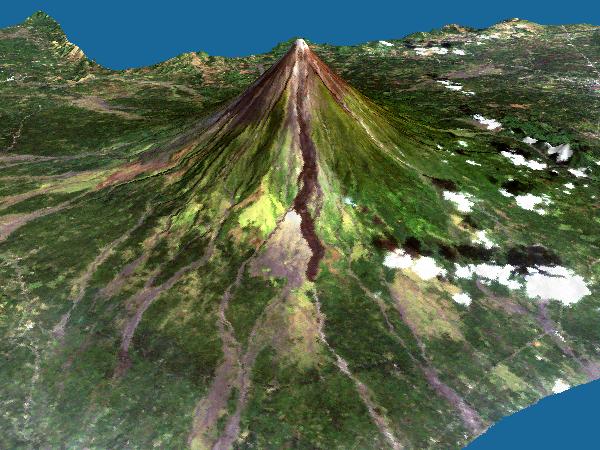
Real Time Volcano
Mapping System Development using Ground Fixed Digital Camera
Digital GMS ( LANDSAT & NOAA Web
Map Server for GMS countries )
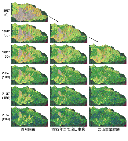
Prediction of forest restoration in ASIO copper
mine
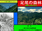
足尾の森林 -破壊と回復の歴史- ; Forest in Asio Copper Mine( Guide Tour, Historical photos and etc. in Japanese)
Evaluation of Erosion Control Work to water and sediment discharge
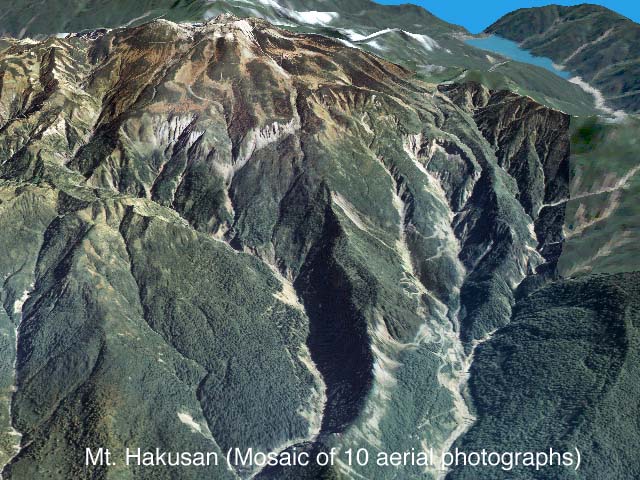
3D Graphics of Aerial
photo for grasping devastated land changes
Forest feature extraction using high resolution remote sensing data
GAME-T ( Servers )
etc....
Software authoring
Image Processing Utility Software(C)
3D CG Software(C)
Check Dam Design Software(Fortran)
Hydrological Observation Data Management System(C++)
Landslide Stability Analysis Software
( Japanese Version ) (VB)
Debris Flow Simulation Software (Fortran) (Result in
Interactive 3D )
lmf
Key Words
Erosion Control, Debris Flow Simulation, Web GIS, Disaster Prevention, Remote Sensing, GIS, Image
Processing, Real Time Mapping, Data Assimilation, Agriculture Modeling
 TSUNAMI WEB MAP SERVER
 The LANDSAT & NOAA Web Map Server for GMS countries |
Ranked 9th in the Top 25 Most Downloaded Articles of AWR |
Ranked
the Top in the Top 10 most accessed articles
Web GIS in practice IV: publishing your health maps and connecting to remote WMS sources using the Open Source UMN MapServer and DM Solutions MapLab, Boulos and Honda, International Journal of Health Geographics 2006, 5:6 (18 January 2006) |